Wednesday 22 November 2017

Update on trigger points

In my post of the 20 August 2017, I looked at urban development trigger points based on land values. This was to inform zoning based on land value. I came up with the following typologies, based on some rough estimates of what type of unit is cheaper to build. The basic idea is that as land values rise, then land area per dwelling unit needs to drops to maintain affordability. Floor area may also get a bit smaller. At some point, higher land values mean that the higher construction costs of apartments sees a dwelling unit that is cheaper to produce than a stand alone or terrace house, even when those types of houses have a much cheaper per square metre build cost. My rough guess was as follows:


Land value up to $1,500 per square metre 
Two storey stand alone houses, town houses and infill type units


Land value between $1,500 and $2,000 per square metre:
Two or three storey terrace or row houses


Land value over $2,000 per square metre:
Four storey plus apartments.


I provided some basic calculations as to costs of producing a stand alone house versus an apartment to get to these numbers, along with assumptions about floor area. For example, the above bands are based on fairly generous apartments and terraces, not shoe boxes.  

In those calculations I did not include developer’s profit. Quite why, I’m not too sure. This is after I had questioned the absence of developer's profit in other calculations of the cost of land use regulations (see 6 August 2017).


So I have had a recalculation.  
Developer’s profit is often based on build costs. My understanding is that 20% of costs is a pretty standard rule of thumb as to what banks will expect as a developers' margin. This is the figure used by the Auckland IHP in its feasibility testing. The recent Auckland Mayoral Taskforce on Housing suggested that developer's margin was in the order of 18 to 22% of total costs (land and building). Whether the developer ever sees this profit is a different issue - this is just a feasibility test.
Including developer’s profit doesn’t really change the basic approach that I set out above.  As the profit is a ratio of build costs, the basic relationships between land values and build costs do not change. Below is my recalculation of the $2,000 per square metre land value scenario, with developer’s profit included.  

The calculation results in an apartment of about $850,000. Interestingly, Colliers recently said that the average selling price for an apartment in places like Albany and Stonefields was $824,000 and up to $ 1.32 million in the CBD.
In my calculations, apartments are about 15% cheaper than stand alone houses, and therefore likely to be a marketable product, when land values are $2000 per square metre. Note, I have also fiddled with the average apartment size (gross floor area) to make it 130 square metres rather than 150 square metres. The 130 square metres is  my guess as to an actual living area of about 90 square metres, with the rest made up by a car park and common access areas (like lobbies, corridors and stair wells).  


Stand alone house
Apartment
Land area (sqm)
         1,000
          1,000
Land value $ per sqm
$         2,000
$           2,000
Total land value
$  2,000,000
$   2,000,000
Building coverage
35%
35%
Storeys
2
5
Floor area (sqm)
700
1750
Costs to build per sqm
$         2,200
$           4,500
Cost of build
$  1,540,000
$   7,875,000
Developer’s profit
$     308,000
$   1,575,000
Total cost
$  3,848,000
$ 11,450,000
Average floor area (sqm) per unit
200
130
Units
4
13
Cost
$  1,099,429
$      850,571


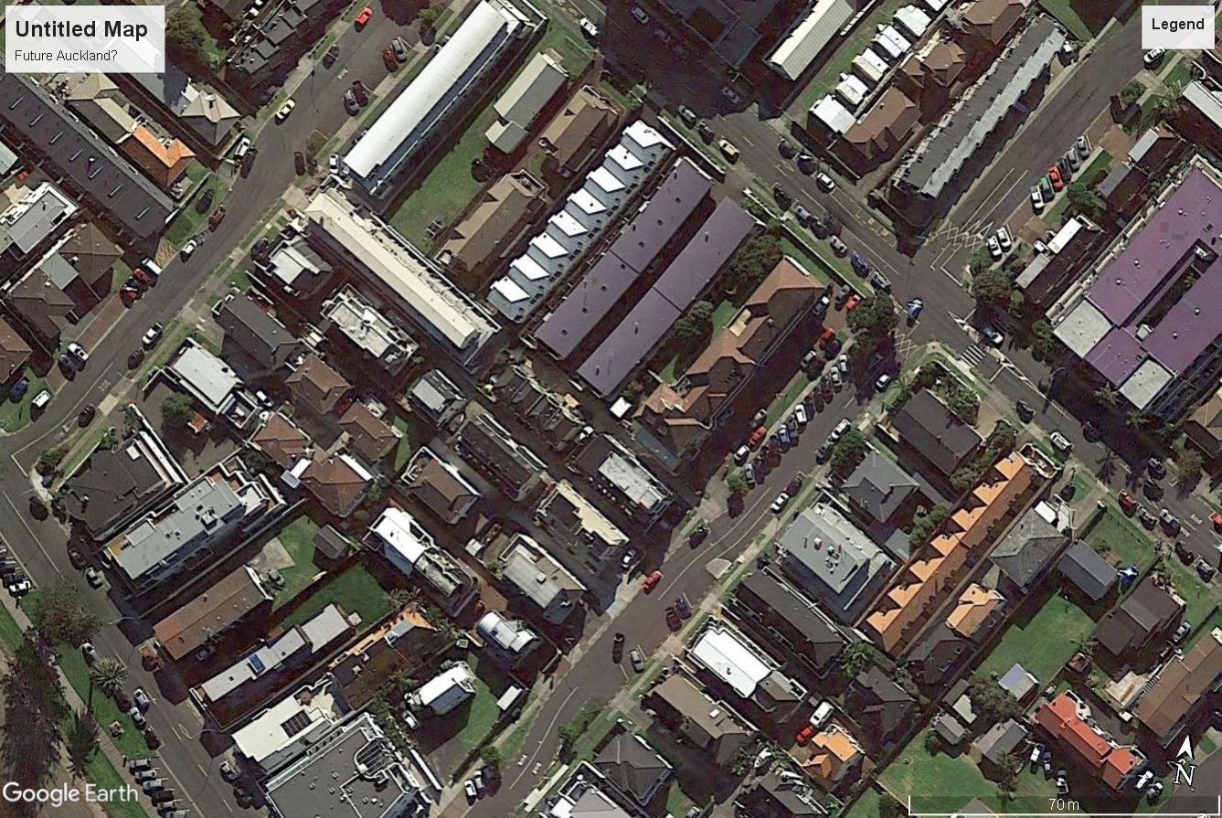
To put the above land values in context, here is a map from Council’s GIS system of land values per square metre for the inner Western Bays, based on 2014 valuations. The red areas are the areas with land values over $2,000 per square metre. These land values will be updated soon with a revaluation occurring this year. Growth in prices between 2014 and 2017 will be reflected in these revaluations. The red areas are likely to have got a bit bigger.  
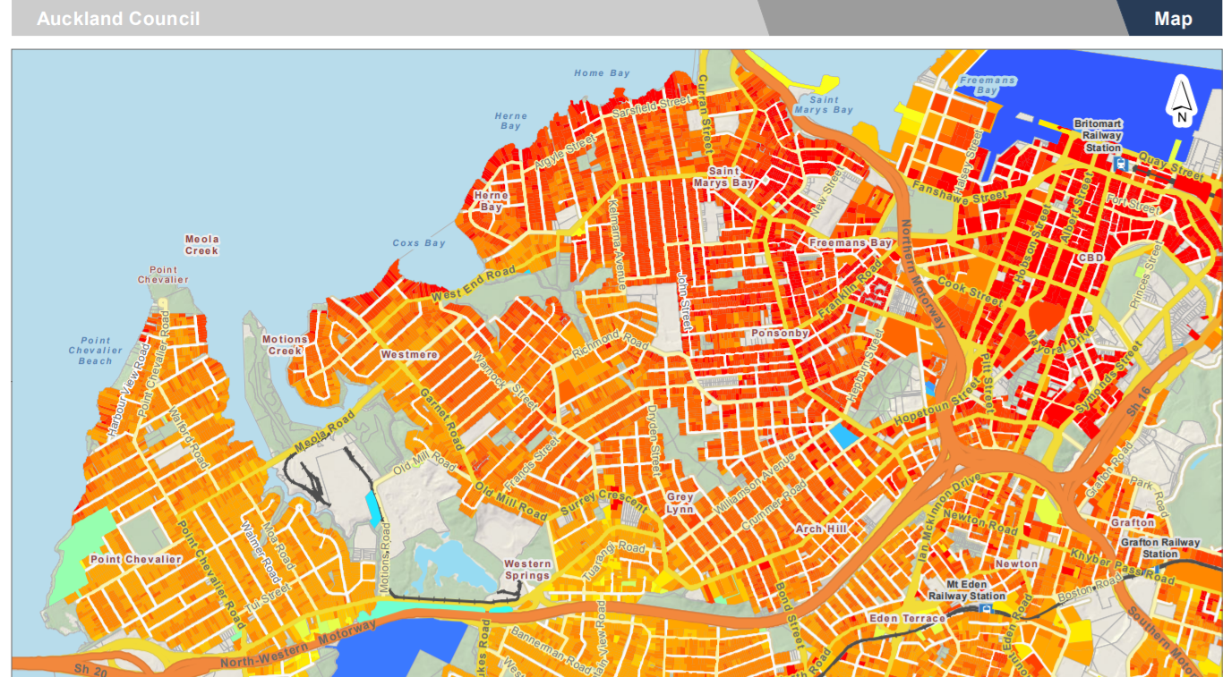
Much of the red is in the Ponsonby / Freemans Bay / Herne Bay area. The coastal edge is mostly red. The darker orange areas like Pt Chevalier are between $1,500 and $2,000 per square metres. It is a pretty quick transition in land values out from the CBD.

If the above map is compared with the one below, which shows recent building consents for apartments and terraces (via the RCG Development Tracker website), then there is a pretty clear co-relation with the red areas.


Great North Road has seen some apartment development. Land values appear to be on the cusp of the $2,000 benchmark, and so tends to confirm the analysis. Great North Road also has the benefit of the former industrial sites. It is interesting how the apartments have developed on the western side of the road, but not the eastern side.

The analysis also suggests that most of Ponsonby and Herne Bay would probably transition over into apartments, if the zoning allowed.
The important point is that apartments are not really that cheap (they are relatively more affordable compared to a stand alone house). They are also really a high land value, inner city or coastal thing. Now of course the costs of the apartment could come down by a cheaper build and smaller floor area per unit, but that tends to lower quality, and narrower the number of buyers.

What is more likely to dominate the orange areas will be townhouses and terrace units - 2 or 3 storey units that share common walls.  More on this soon.

Friday 10 November 2017

New urban agenda 2


“This government will take steps to improve our resource management system, with better spatial planning and better enforcement. An urban development agency will be introduced, and more emphasis placed on public transport and light rail.
This government will remove the Auckland urban growth boundary and free up density controls. New developments, both in Auckland and the rest of New Zealand, will be able to be funded through innovative new financing methods like infrastructure bonds. This government will also give Auckland Council the ability to implement a regional fuel tax”.
A couple of blogs back I made some off the cuff remarks about the National and Labour parties election statements on urban areas. I said Labour had the more consistent sets of policies. I may have been a bit hasty, given the above? Quite a lot in those few lines above. They are from the new government's speech from the throne setting out their legislative ambitions.  


Better spatial planning sounds good. But to what end? Will efficient and equitable urban areas be the goal (or just speedier development?) Will climate change adaptation get a serious look in? The question is how you link the spatial planning into the RMA system. There have been mutterings of an urban planning act, but no mention of that.


Urban development agencies also sound good, and with a left leaning government, hopefully they will have more of a public good function to them than the national government’s proposed use of such agencies to attract private investment and speed things up. However such agencies need funding (big amounts of funding) if they are to amalgamate land and promote urban redevelopment.
More emphasis on public transport and light rail. Tick. We need more mixed use zoning along collector and arterial roads that allow for small workplaces as well as apartments above.


Regional fuel tax. I think we are quickly getting to the point where more ‘flat rate’ type taxes to fund transport are not really much use, apart from raising a bit more revenue. But with the growth of electric vehicles and ever more fuel efficient petrol and diesel engined cars, then even as a source of revenue you begin to wonder about petrol taxes. Time for charging for use of the transport network that is route and time specific.


Infrastructure bonds. The idea of government using its size and power to borrow money and back long term bonds to fund  infrastructure upgrades and extensions is probably sensible. The question is who pays the interest and capital - the taxpayer, the rate payer or the user of the infrastructure to be provided? It should really be the user these days. But there are tricky issues to sort out in brownfields areas as to catch up, renewals and growth related costs of infrastructure. Making the user pays in greenfields areas will not make housing any cheaper in these areas, but it is necessary that we limit any subsidies to create an even playing field between expansion and redevelopment.


Free up density controls. This has kind of happened already in Auckland. However there are some issues to resolve, not least of which are urban design issues with the re-emergence of the modern day ‘blocks of flats’ that sit side onto the street,  occupying most of a site with the units looking out over the neighbours back yard. Somehow we need to keep hold of back yards and concentrate more of the bulk of development to the front (road side) of sites.


I think there is also a case to re look at the zoning of the ‘middle ring’ of suburbs - those about 5 to 15km out from the CBD. There is an argument that there should be more three storey development in these areas, with 4 stories along collectors. Busy arterial road corridors (more than 20,000 vehicles per day)  are probably better suited to business uses these days. This all needs to be supported by more investment into open spaces and better street environments, stormwater management and the like. In fact these areas requires a massive investment of funds if compact Auckland is to work.  Finding a funding source is key.    


The odd one out is the removal of the Auckland urban growth boundary (which I guess means the newly minted Rural Urban Boundary or RUB). The RUB is not a fixed things these days - it can get shifted. By what is to be gained from its removal?


New towns? While ideas of new towns sound attractive, they always struggle. Good transport links are needed back into the main metro area as the towns are never self sufficient in terms of jobs, shops or services like education and health.  The transport links would need to be fast if the commute time penalty was not to be too high which suggests new dedicated routes (read big dollars), while any rapid transit link can’t serve all regional employment destinations.  Equally important is how the new town is funded. Ideally, the government buys the land involved at above rural land values but below future urban values; rezones the land, puts in the infrastructure and then sells the land onto developers at the urban value, with the difference used to fund the infrastructure. But is the government really going to go out and force a bunch of rural landowners to sell up at what to them will be a value they think it less than what they deserve? And does this mean the sections will be that much cheaper than might otherwise be the case? On the positive side, at least some of the uplift involved is used for a public purpose. But you don’t need to remove the whole RUB to advance this type of approach.


The other reason for removal of the RUB is to increase competition between landowners over who gets to subdivide. If all land within about 20km of the edge of Auckland is up for grabs, then there may be less of a premium to land that could be subdivided. While attractive, the idea misses the point that there is a form of spatial monopoly at play. Auckland tends to grow along three main corridors (north,north-west and south) so land close to these corridors is always going to have a head start over other land. The more likely outcome is public investment being scattered across the countryside, busy trying to serve a number of new housing ‘hot spots’ crying out for attention because of their poor roads and limited infrastructure. This also gets back to the issue of the infrastructure bonds - who pays?


The RUB is a tool to achieve a number of outcomes. It is possible that this type of omnibus method gets replaced by a bunch of more targeted (possibly more effective) methods. If you look at what the RUB is trying to do, then it is not too hard to think up other (and perhaps more targeted means) of managing the different issues.


Issue
RUB
Alternative
Poorly priced transport systems. Cities can expand more than they should if transport network use is under priced
Slows outwards expansion of urban areas,
Road pricing / congestion taxes
Environmental protection - significant landscapes and environments that contribute to sense of place
Seeks to avoids urban growth in very sensitive / valued areas
‘No go’ areas identified and protected by specific statute (a bit like Waitakere Ranges)
Infrastructure funding and efficient roll out networks
Releases land for development once commitment to funding is in place
Spatial planning to set out programme of network infrastructure extensions, with partial user pays in the areas to be served.
Full user pays for out of sequence network extensions
Maintenance of rural production, rural landscapes
Provides certainty for rural productive activities
Open space / landscape covenants or similar


There is also an important timing issue. If the RUB is to be ‘removed’, then it should only be removed after all of the other actions are in place, such as:


  1. Better spatial planning that defines ‘no go areas’
  2. Secure funding and implementation of public transport / light rail projects
  3. Sorting out how to pay for infrastructure
  4. Road tolls  / congestion charges (a petrol tax is a poor second here)
  5. Urban redevelopment authorities in place and underway
  6. Some sort of rural landscape protection scheme - not just outstanding landscapes.

Hopefully there is some recognition of these critical timing issues.