The decline of housing supply in New Zealand: Why it happened and how to reverse it Te Waihanga Research Insights series March 2022
Another report on the failures of planning contributing to today’s housing crises. This time from the Infrastructure Commission.
The report says that in the space of a generation, housing has gone from being abundant and reasonably affordable, to being scarce and prohibitively expensive.
Setting aside the numbers, the Commission’s report explores how the relationship between land use and transport costs has determined urban form (and with it housing choices and costs). But is it transport leading land use or land use leading transport?
On the transport side of the equation, the report makes that valid point that the creation of Auckland's motorway network in the 1950s onwards saw rising travel speeds which facilitated housing supply by increasing the area where new homes could be built. Auckland’s built-up area expanded rapidly during this period. When growth in travel speeds slowed in the 1970s and then began to reverse in the 1990s, urban expansion also slowed down as it became less attractive to build at the edge of the city. Changes in urban travel speeds between the 1970s and 2010s increased demand for housing in inner suburbs that were less affected by rising congestion.
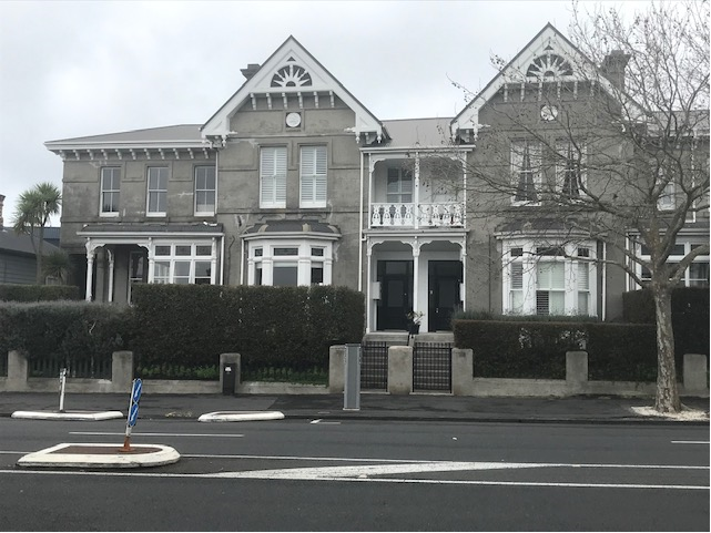
On the land use side, between the 1930s and 1970s, planning rules made it easy to build new houses or apartments in existing suburbs and to build new suburbs on the fringes. In Auckland, plans provided enough capacity for central suburbs to triple in population. However, planning rules became more restrictive and more complex over time. Central Auckland’s capacity for new housing was cut in half in the early 1970s – a change that was partially reversed in the 2016 Auckland Unitary Plan.
Did planning fail to foresee the drop in travel speeds that heralded intensification rather than expansion? Perhaps not, since there is plenty of evidence of planning trying to facilitate urban redevelopment. Perhaps more relevant is the narrative of residents of established suburbs clearly foreseeing the growing pressure for redevelopment of their neighbourhoods and seeking to put the brakes on this process through controls on density and infill.
But what of the infrastructure to cope with the pressure for infill and redevelopment? Did the slow supply of infrastructure to support a more intensely developed city also contribute to the reluctance to open the zoning door more fully to redevelopment? Mid 1990s and there was serious consideration being given to the closure of Auckland’s suburban rail network. Trains were going to be replaced by buses. Buses were cheaper to buy and run and more flexible, especially given the low density, dispersed land use patterns generated by the post war motorway driven suburban expansion. The 1999 Auckland Regional Growth Strategy placed a heavy emphasis on urban consolidation. Central government and major infrastructure providers refused to sign up to the strategy – they didn’t think it would be implemented.
What to make of the Commission’s contention that planning was slow to respond to congestion and higher transport costs, resulting in the housing crises we face today?
Let’s start with house construction. The Infrastructure Commission’s report doesn’t actually have any tables or graphs on new house numbers; rather a graph of percentage increase in dwelling numbers over a 10-year period, compared to the stock of dwellings at the start of the 10-year period. For some reason the data stops at 2018, rather than 2022, when all the evidence is that house construction has accelerated quickly over the past 4 years. A bit strange for a report that is supposed to be about housing supply.
The figure below is the relevant graph from the report. I guess the idea of the percentage change over the previous decade is to get a sense of how much resource was devoted to house building. In the 1950s, housing stock increased by over 30%. In actual numbers, 30% may not be that much if the starting point was low. But nevertheless, a 30% increase must have occupied a large part of the national economy.

I don’t have the numbers but presumably at the time the government had more ability to plough a large part of its expenditure into housing as other calls on its resources like health and social welfare were probably more modest than they are now.
In terms of actual numbers, the last four years have seen a massive upswing in building consents issued. The graph below is building consents issued for new dwellings, across New Zealand.

As for floor space consented, larger homes mean more resources are being consumed by each dwelling, so it’s not a straightforward comparison between a house built in the 1950s and a house built in 2022.
Below is the total floorspace consented per decade. The amout of floorspace consented in 2010 to 2020 was similar to that of 2000 to 2010, so pecentage wise no difference between the two decades, but in absolute terms, a large amount of floorspace was consented in both periods.

Both the number of units consented and floor area consented shows a pretty strong picture of the housing market responding to growth pressures and rising prices. All this in what is supposed to be an environment of limited housing capacity. Perhaps the response was not fast enough, and more capacity would have enabled faster building, leading to less stress on the system. But housing markets are notoriously slow to respond to demand shocks, and now building material and labour supply constraints are present.
Let’s take a closer look at the capacity side of the equation.
The Commission’s report says that 2006 is seen as the low point for capacity enabled by district plans, after a high point in the 1970s.
In Auckland, the 2006 capacity for growth study states that the (old, pre 2010 amalgamation) Auckland City District Plan of 2005 had room to accommodate about 70,000 more dwellings on top of the 144,000 already present. So, about a 1.5 ratio of capacity to current stock. The break down is as follows:
• Existing Dwellings: 144, 285
• Potential dwellings vacant land: 7,058
• Potential dwellings redevelopment: 18,376
• Potential dwellings business areas: 44, 480
• Total potential 69,914.
Is this enough capacity?
The Commission’s report shows that a 50% buffer of capacity was maintained through the 1980s and 1990s, so the planning system was not static in its approach to capacity. Housing capacity continually expanded during this period. Expansion of capacity was incremental, but in the face of a sceptical government, cautious infrastructure providers and restless residents, what other strategy was to be pursued?
Business areas took on more of the role of providing for housing capacity. The early 1990s saw the emergence of Mixed-Use zones in the inner Isthmus area. Maybe there wasn’t enough attention paid to capacity in residential areas (where most people would likely look to live), but nevertheless the concept of redevelopment was part of the planning approach.
The question not asked by the Infrastructure Commission is whether debates and uncertainties over the upgrade and replacement of old infrastructure to support infill and redevelopment of existing urban areas slowed down the response of the land use planning system.
For example, there has been a huge lag in transport investment switching away from road-based projects that serve suburban development to public transport-based projects that support intensification. Even the 2013 Auckland Integrated Transport Programme (ITP) devoted the vast bulk of future spending on new infrastructure over the 30 year span of the ITP on new roads.
By my calculation the headline split between roads and PT is something like 70/30:
• Roads $22,287 million
• PT $8,476 million.
Some roads spending benefits buses, but nevertheless there is a significant bias towards roads and cars.
Public transport has always faced the problem of who pays for it? Roads get paid for by motorists who pay petrol tax (and often the environment that has to put up with pollution); public transport gets paid for by a messy mix of users, motorists, ratepayers and taxpayers.
Water, wastewater, and stormwater infrastructure in brownfields areas is often near its capacity or in need of repair and renewal. Who pays for this? Existing ratepayers? Not likely.
We may decry NIMBYs, but whether infrastructure will be upgraded as the city intensifies is a legitimate question to ask, and often the reply back is murky. No wonder the planning response to the changed urban dynamic of transport costs favouring infill and redevelopment over expansion was modest and half hearted.
So is the slow response to infill and redevelopment pressures to changing transport costs the result of land use planners, or uncertainty over infrastructure? Read the Commission’s report and the urban expansion of the 50s and 60s was fuelled by transport investments cannily matching consumer preferences supported by lots of greenfields capacity; but come the 90s and onwards, consumer preferences are stymied by slow planning, rather than insufficient infrastructure.
At least the report doesn’t pin the blame of high house prices and slow supply responses on urban limit lines and the like. There seems to be a tacit acknowledgement that by the 1990s, transport costs were seeing rates of greenfields growth slow, at least in Auckland. Yet so much of the debate in the 2000s was about dismantling the urban fence as the way to tackle the housing crises, not how to support redevelopment.
Now the wheel is turning again, and again there is the potential for a miss-match between land use and transport infrastructure to emerge. Has covid and technology accelerated a trend away from the monocentric city with its radial transport routes and its rings of land values and density diminishing as distance from the centre increases. Is a new neighbourhood-centric city emerging?
The report concludes that urban housing markets will continue to change, and we may need different infrastructure to facilitate those changes. Carrying on with a ‘business as usual’ approach can limit housing supply.
Hopefully that last sentence is directed at infrastructure as much as it is to land use planning.